
Our favourite trails
Trails we love to run, hike or plod along!
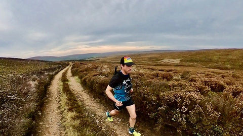
This month we discover the trail running route our ambassador Tim Pigott loves to run time and time again. Tim, a Physiotherapist, coach and Scarpa athlete has competed in some of the UK and Europe's toughest races with has favoured distance being anything over 100km! Notably, Tim won the Montane Spine Challenger, setting a new course record in 2022.
Over to Tim...
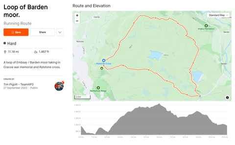
The Loop of Barden Moor Trail Route.
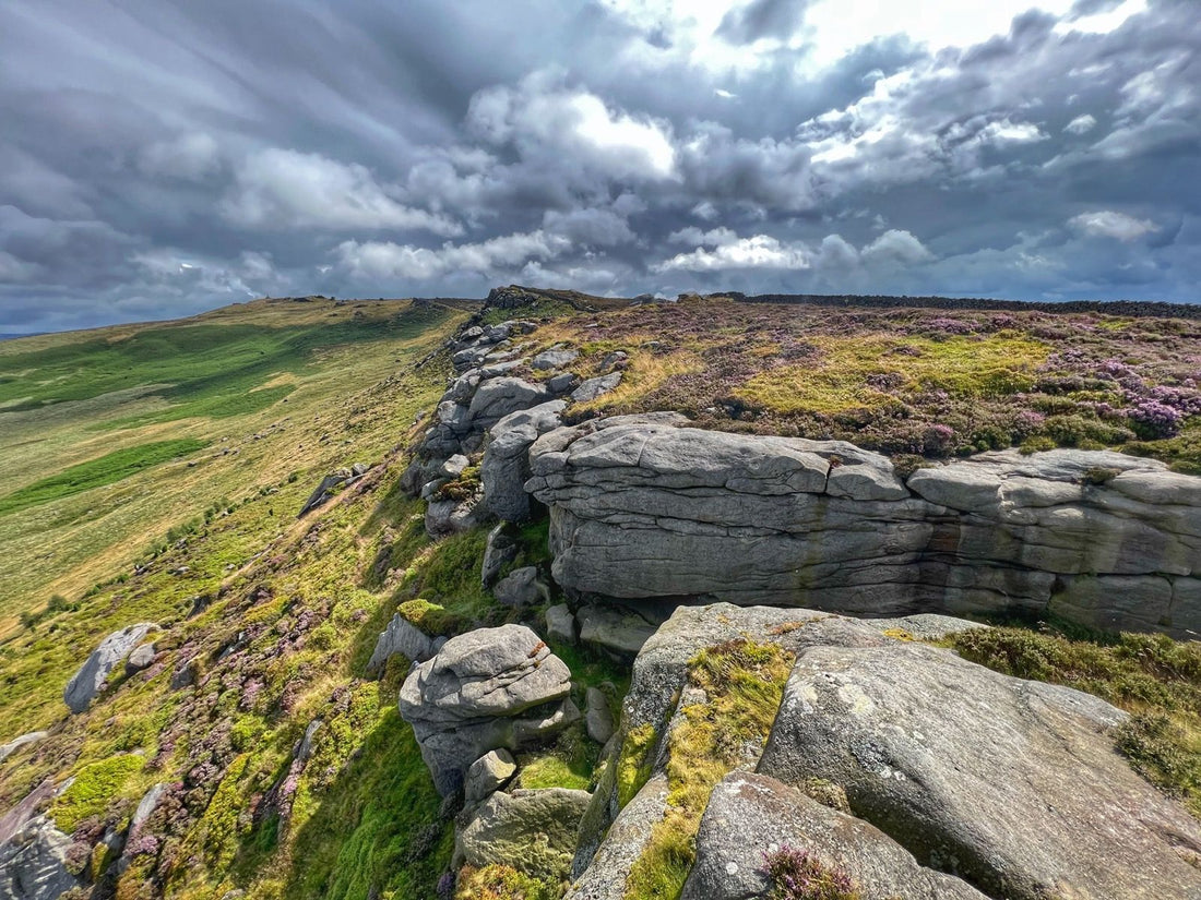
The Yorkshire dales have so many superb routes to choose from, but this area just North of Skipton (the gateway to the dales) is one of my favourites. This 18km circular route loops Barden Moor taking in Cracoe War Memorial and Rylstone Cross, with a total ascent of 447m. The trail running is mostly on good hard packed trails (4x4 track for the gamekeepers, some fun sandy gritstone singletrack, and a little bit of mud! The climbs offer some amazing views out into the surrounding dales, and while you are never that far from civilisation, at times you feel that you are in a remote part of the countryside. I often pick this trail when I’m needing to switch off from the world! It’s hard to imagine that these moors were once busy industrial sites, with mining activity, quarry workings and peat extraction. The evidence left being some coal ridden spoil heaps and a few mine shafts. Of the reservoirs you run past, the upper one is notable for being the first in England to use concrete extensively in the construction of its’ dam.
*It should be noted that this route makes use of the Bolton Abbey Estate’s Barden Moor access area, and although most of it is on public rights of way, some sections are on access land and permissive paths, which can be closed for shooting. Dogs, sadly, are not allowed on the majority of this route.*
Where to park for this trail run?
The best places to park are the various parking areas on Barden road either at the summit of Black hill, or just north of here as you descend towards Barden, before the cattlegrid.
What 3 words for car parking location: //informer.udder.norms
You can do this loop either clockwise or anti-clockwise – I prefer anti-clockwise as it means you finish with mostly downhill rather than a steep uphill slog on the road!
This route does take you onto the high ground, and as mentioned, it’s somewhat remote. So always make sure you pack your waterproofs, spare layer, and emergency bivi, irrespective of the weather forecast (this is the UK after all!).
The trail route.
1. Heading towards Lower Barden Resevoir.
Cross the cattle grid and immediately go over the stile on your left to take you down the road to Lower Barden Resevoir. Just before you reach some buildings take the gravel track to your left. Follow this to the top of the reservoir and there is a finger post directing you sharp right and over the metal bridge, to then follow a narrow trod (path) up through the heather to the gravel road.
2. Past the Grouse Butts
Cross over the gravel road and follow the track up and over along the hill. In front of you are superb views across to Simons Seat. Pass through a wooden gate, then just before you reach a wooded plantation take the track left through another gate, past a shooting butt and down and over (or through) Gill Beck. Now follow the track as it gradually climbs up Simm Bottom, past more Grouse Butts as you head North in the direction of Burnsall.
3. Which way will you go?
At around 3miles/5k you reach a slight crossroads with the obvious gravel track going left, or a more overgrown gravel track continuing straight ahead (and a very overgrown track off to the right). I prefer the track going straight ahead as it allows you to take in a couple of extra high points and cairns. If you take the left turn simply follow this, past an old chimney (evidence of the old coal mine) and the two paths re-join again near a shelter.
4. Enjoy the views of the Dales!
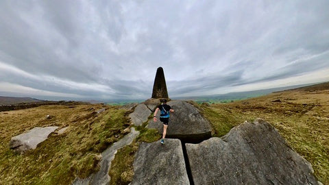
You are now treated to stunning views North into the Dales as you track West along the edge of the plateau. Eventually the track starts heading South West and you can see the War Memorial (Oblisk) standing proud on a rocky outcrop.
The Cracoe War Memorial was build in 1922 from gritstone as a memorial to Cracoe’s 13 fallen soldiers after the First World War. A further three names were added after the Second World War.
At this point the gravel track peters out into a grassy then muddy single trail following the Eastern side of a stone wall. If it has been wet then this section will be boggy and you will get your feet wet! You’ve been warned.
5. Run up to the memorial
The path stays to the left of the wall, but it’s worth climbing the stile to go up to the War memorial and take in the views from Watt Crag.
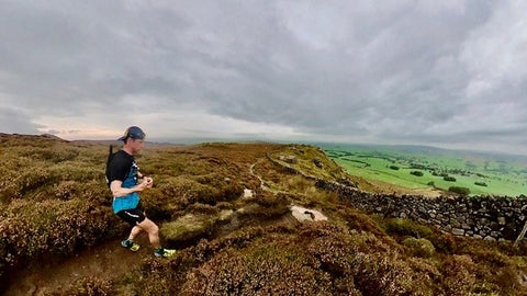
From here follow the mixed single track trail, keeping the wall on your right. The trail here is a real mix of rocky millstone grit, sand, peat substrate, mud, and everything in between. On dry days it is a sublime single track where you are dancing from rock to rock.
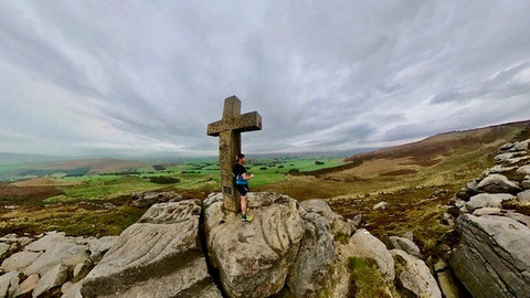
6. Climb up to Rylstone Cross.
As you continue to track south you then climb back up to where Rylstone cross is, again it is worth going over the stile to take in the views from the escarpment, now looking West over Rylstone, Hetton and beyond.
The original cross on Rylstone Fell was erected in 1783 to mark the end of the American War of Independence, although that then fell at some point. The sandstone pillar that the current cross sits on was built in 1815 to celebrate the Peace of Paris at the end of the Napoleonic wars. A cross was then added to mark Queen Victoria’s golden jubilee, although this fell into disrepair and a new cross was erected in 1995.
7. Rylstone Bridleway
Shortly after descending from Rylstone cross you reach the main track, the Rylstone bridleway (Gate, and usually a large puddle, on your right). Turn left and follow the initially narrow single-track East. This quickly turns into a wider gravel singletrack as you then climb up to where some shooting shelters are off to your right. Join the large gravel road and Continue East up a very gradual incline.
8. The final climb, and descent!
A small stream (Gutchen Gill) cuts across the track as you swing left and you gradually climb back up before a final descent to your parking area.
If you parked at the Black Hill summit there is a small single track which then cuts right just before a metal gate which will take you up and over the hill (Halton Moor) to your parking area.
The route map
Download the GPX file for The Loop of Barden Moor Trail Run here.
Enjoy! Don't forget to tag us in you images or videos @sidasuk
Tim’s kit for this run:
Sidas Run protect insoles in Scarpa Kalibra HT (boa)
Sidas Ultra Trail running socks
Sidas cedar dry bags for after the run.
Follow us on Instagram, Facebook and NOW Strava