Our favourite trails
trails we love to run, hike or plod along!
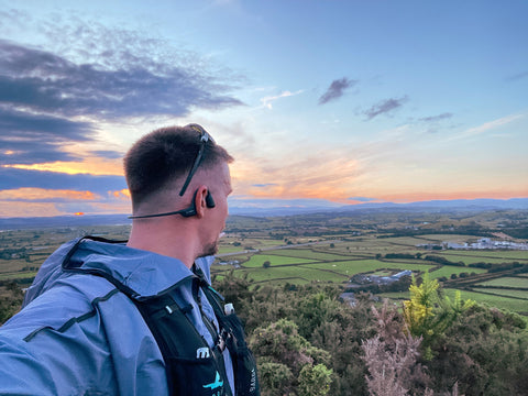
The start of a new series of trails from our team, athletes and ambassadors. Volume 1 comes from our marketing manager David, who was recently bitten by the trail running bug, when working at The Ultra Trail Snowdonia. Now a few months into his trail running journey, David introduces you to one of his favourite local trails.
Lancaster Canal Path & Farleton Fell Trail Route.
Living in Endmoor, just outside of Kendal I have a wealth of trails either from my door or just a short drive away. However, since discovering this route it has become one of my favourites... especially on a clear day or evening. This particular route has a great mix of tree lined grassy canal paths, interesting climbs, and challenging scree descents linked by quiet country lanes.

Where to park for this trail run?
I have started this route from the Kendal/Lancaster Canal Head car park which 2 minutes from J.36 off the M6. You will be able to see this on the GPX file provided, although you could extend the route, slightly, and park at the Crooklands Inn... then you can grab a refreshing reward afterwards.
So, we're all parked up, Sidas Trail Socks on, trail runners on, lets get going... and hit the trail.
The trail route.
1. Hitting the Canal Path
From the car park go through the gate and take a right turn to go under the M6 fly over. Once you come out from the under pass there will be an opening on your right which re-connects to the Lancaster Canal Path, turn in here and enjoy the tree lined path way, which follows the canal on your left for about 1km.

2. Take the turning.
After you have followed the canal path for approx. 1km you will come to a small tunnel that goes under the A65. Exiting the tunnel, there is a left hand turn take this and head toward the A65, you will pass a row of houses on your right as you come out of the small wooded area. Head to the end of this housing and there will be a gate to enter into a field. Run downhill through the field and bear left towards the gate in the bottom left corner of the field, as you look down the hill. Go through the gate and run up through the next field towards the farm. At the end of the field take a right turn down the lane.
3. Head up to Farleton Fell
At the end of the farm lane take a right turn out on to Dovehouses Lane, follow the lane for around 0.4km until you reach the junction. Take a right hand turn over the stone bridge on to Nook Lane and keep running along this road for approx. 0.48km to the Puddlemire Lane junction. When you reach this junction take the left hand turn and start to ascent up Puddlemire Lane for 0.9km until you reach the gate to start and ascend Farleton Fell.
4. Start the ascent!
As you start to climb from Puddlemire Lane you will start to see some stunning views towards the Lake District.

Head up the climb for around 150m, then take a left hand turn and climb up again for around 140m with 40m elevation. You will come to another track, turn left through the bushes and ferns.

You need to continue on this track for around 0.4km when a few paths/tracks start to meet, keep following the same track, climbing 22m over 220m. The track meets another pathway, continue straight up for about 110m... then turn right and traverse for about 60m then bear right and continue for around 190m then turn right.
5. Final push to the summit!
After turning right, continue the steady climb up towards the summit of Farleton Fell. Keep on this track climbing steadily 33m, over 0.68km to reach the top! You will be rewarded with amazing vistas of the Lake District (N,NW), The Howgill Fells (NE) and Morecambe Bay & Arnside (W, SW)

6. Time to head back down...
From the summit start to head back down the opposite side of the fell... bear left and follow the track down the pretty sharp descent, it can be a little loose under foot with a mix of rock and scree. You will follow the descent for around 0.47km and it will bend to the right and traverse across the face keep following this path down the hill.
There are two tracks which come off this one down to the left, these are a steep scree descent, if you want something a little more 'challenging', I took this route on one of my runs and it was almost like 'skiing on scree' down the slope... back the route!

Keep following the trail until you reach the intersecting trail, around 160m, then turn right to traverse across for 60m until another intersection. Take a left turn downhill for about 30m and bear left at the intersection path follow the trail for about 150m through the trees to the stile. 'Jump' over the stile into the field and head straight downhill towards the houses, where you will find a small opening to go through... welcome to Farleton. You will emerge onto a bend on Nook lane, turn left towards the main road (A6070) then cross over at the cross roads and head up and over the bridge over the canal.

7. Back on the canal path.
Just as you come over the bridge, there is access to the canal path on the right. Head down the slope and back on to the canal path head back towards Kendal/Crooklands.Stay on the canal path for 2.55km all the way back to the A65 and the M6 flyover at the start, opposite the canal Texaco garage. Now for the sprint finish for the last 80m!
The route map
Download the GPX file for Lancaster Canal Path & Farleton Fell Trail Run here.
Enjoy! Don't forget to tag us in you images or videos @sidasuk
Follow us on Instagram, Facebook and NOW Strava


